|
|
||
|
|
"Alexander's march, Abu-Lughod's ovals, and other curiosities of world history cartography"Michael McInneshin
|
|||||||||||||||||||||||
|
The origins of this essay lie in my own experiences in education. As an undergraduate, in a course called Geographical Perspectives in Asian History, we students were assigned a meta-reading of an historical atlas, analyzing the authors' choices for inclusion and exclusion of certain geographical-historical narratives. The lessons of this exercise, namely that maps have authors and arguments, have stuck with me ever since. When I began teaching on my own, a student posed an astute geographical question in a Western Civilization class that addressed the same problem. As we were looking at a map of Alexander the Great's conquests he asked, "Why don't we count Persia as part of the West anymore? How do 'they' know where to draw the line [between West and non-West]?" I stumbled through a paraphrase of J.M. Blaut's "Colonizer's Model of the World," tried to discuss the twentieth-century invention of the Western Civilization class, and then moved on to the impact of Hellenization. (I did not know S.A.M. Adshead's idiosyncratic and Persia-including definition of Western Civilization at the time, or I might have been able to confuse the students further.1) Years—and many textbooks—later, I noticed that the path of Alexander's army was replicated in every global history textbook I owned, and I was reminded of the student's query.
Why then, was this particular campaign supremely valued by textbooks beyond any other? Why not the march of a Han general, Asoka's conquests, or Julius Caesar's circuit of Gaul, just to name his very rough contemporaries?2 Sure, Alexander was admired even by West Africans and South Asians more than a millennium after his death, but did that apply to historical cartographers as well? Part of the answer certainly lies in the availability of sources to follow that army's motion, but other ancient campaigns have produced enough records to trace. Part of the answer also lies in the utility of explaining cross-cultural encounters and the historical process of the Hellenization of mid-Eurasia, but the weight of the answer lies in the history of the historical atlas. Due to their own preoccupation with education about the Classical Mediterranean world, compilers of historical atlases in the eighteenth and nineteenth centuries repeatedly printed the Hellenic army's route.3 Because new historical maps have always been expensive to make, historical map-making tends to conserve hard-won knowledge, and the maps with this DNA have been replicated since that time. More scrutiny of world history textbooks reveals that the reiteration of cartographic history tropes is not unusual. Certain mappings of history have been duplicated through time and across publishers. Some graphic renderings have become so recognizable that they almost resemble those overly familiar images that populate every world history textbook: We are all conversant with the terracotta sculptures of Shi Huangdi's soldiers, photographs of extant Roman aqueducts, sketches of Zheng He's treasure ships, and the Catalan Atlas's depiction of Mansa Musa holding aloft a gold nugget. To those icons we might add the Taklamakan salient of the Han Dynasty, the shape of Trajan's Roman Empire, the paths taken by Zheng He's fleets, and the boundaries of the second-millennium Niger bend empires. This is not to suggest that these depictions in and of themselves are problematic; they are, after all useful to explain some aspects of history. But the heft of these repetitions means that certain narratives trump others, and different possibilities of illuminating the past sometime get obscured. I should note that I delight in the richness and beauty of cartographic data available, and that textbook cartographers are largely not to blame for their maps' shortcomings. Using maps to represent the past is intrinsically problematic. If we regard history as the study of change over time, then individual paper maps inherently—being static representations—are not good at depicting history. For example, maps at the world history level typically are hard-pressed to illustrate both the rise and fall of an empire, at least within a single graphic. Map-makers have created a few strategies for working around this major problem: arrows or other symbols representing movement and change, colored or shaded gradations of map features, and series of maps covering the same region. None of these methods are fully satisfactory, but neither would a year-by-year mapping be feasible or even useful, as the reader would be inundated with information inappropriate for the scale of world history.4 Maps that depict long stretches of time also have difficulty demonstrating intermittent or briefly occurring events. Likewise challenging is any attempt to map competing historical interpretations. So why do teachers of world history need to look more closely at these flawed tools? First, elements of maps function as immensely powerful arguments about how the world is geographically constructed, even if geographical memories are not exactly precise. Our students may not be able to draw the borders that make up the states of Africa, but they know that the continent's territory is completely covered by countries, thanks to the brightly colored political maps they have been shown all their lives.5 Maps persuade map readers not only about how the world is (or was) constructed spatially, but also how the world should be constructed spatially. This authority derives partly from cartography's mantle of science, the notion that maps merely reflect the world objectively: "Mapping is . . . seen as a purely technical exercise, a matter of simple description."6 All maps are in fact claims about reality, but their arguments often go unregistered as arguments.7 Of course, the fact that the map is not the territory makes it a necessity for cartographers to condense and select information in a fashion uncluttered enough to depict the historical trend or event intended. So certain geographical realities—including people—are always left out of the map.8 (This is not a new concern for historical cartographers.9) As map users, we should be cognizant when important elements have been discarded to make the map. Because the arguments of historical maps are powerful, they must be handled with care. Second, understanding maps as arguments means "doing" history, rather like examining written secondary sources for their arguments, evidence, and biases. Teaching specialized map literacy to our students is something we can employ in the classroom to show how evidence is deployed in another medium, and to explain how the generalities of the global past might be complicated. We can also track the unintended messages that historical maps foist on us. Global historians in print have been instrumental in de-centering and re-centering places and concepts in particular eras of world history, and insisting historical narratives recognize more of the world as a whole. Cartographic representations have sometimes lagged behind texts in these innovations for reimagining the world's past, and the inherent conservatism of map production often produces depictions that undermine these reconfigurations. The "truths" of the historical map have often served to replicate elite history, even as peasantries and commoners' commodities have been spotlighted in recent literature. Some map constructions inadvertently perpetuate the "Western Civilization plus" model of the earliest world history courses, even if the texts no longer reflect this approach.10 Teachers will produce better global history with this map awareness in mind. Parameters Below I will examine a selection of textbook maps to discuss what arguments they are making, both intentional and unintentional, and the impact of those arguments on the world history that the maps delineate. For reasons of space, I have limited my analysis here to the maps from the standard first volume (before 1500) of the four world history texts I have chosen. I have selected these four because they cover the three basic models used by world history texts to order information, and I am acquainted with at least one author's scholarship from each book. Although none of these formats is completely pure, and they share strategies of coverage, they can generally be labeled as a) predominantly a sequential regional analysis, b) an emphasis on chronological analysis, and c) a principally thematic analysis. The regional approach is by far the most common structure for world history texts on the market; Richard Bulliet's The Earth and Its Peoples (henceforth in the text: Earth) serves to represent that group here.11 Even though this category of textbooks often emphasizes interregional interaction and contact, they reveal that "the [Toynbeean] assumption that civilizations are isolable units of human association continues to inform most historical atlases and textbooks."12 The chronological model I have chosen is Robert Tignor's Worlds Together, Worlds Apart (Together).13 The proxy for the thematic archetype is Ways of the World by Robert Strayer (Ways).14 Finally, Felipe Fernández-Armesto's The World (The World) demonstrates a particularly hybrid approach.15 For the purposes of a truly global history, my own prejudice tends to lie toward the chronological approach, as it often takes the globe as a unit, and its form does not undercut the current scholarly emphasis on interconnections. The comparative aspect is crucial here. If the themes of world history are "commonalities among societies" and "contacts between civilizations" or "cross-cultural comparisons and connections" or "the commonplace material bases of all human societies," then I reason that a textbook's organization should be structured to promote these comparisons.16 In
each subsection below I will largely be focusing on the cartographic tropes
common to the texts. I will discuss the utility of these maps, disclose
their problematic silences, and scrutinize their unintended
messages. I will also examine a few outstanding and unusual outlier
maps as well. Environmental Maps Three of the textbooks under consideration relegate the global maps of physical geography (sometimes unkeyed) to the end pages; only The
World incorporates this global geography into the midst of the text.17
While the placement of these sorts of maps is logical, this strategy weakens
the potential of comparing geographies across regions within the
chapters. There are two other subtle problems with this
arrangement. The first is the inadvertent implication that climate and
vegetation patterns have remained static during human existence, while we know
that even the Sahara was for a time wet since the invention of agriculture, and
that substantial deforestation took place across pre-modern Eurasia and in some
portions of Africa and the Americas. Ice ages (and the attendant extended
coastlines) are shown in the textbooks as having an impact on the original
spread of Homo sapiens, but less drastic climatic variations—and their
meaning for human lives—are mostly ignored.18 The other issue
is an almost imperceptible Euro- and perhaps Sino-centrism. A few
regional maps of Africa and the Indian Ocean include vegetative cover and
weather systems as important factors to historical developments in those
places.19 However, the
climate is never graphically used an explanatory tool in the development of
Europe or China, as though the inhabitants of these realms operated on a blank
landscape. In other words, "savages" were confined by their surroundings
while the "civilized" had conquered natural forces. I would posit that
this trope is the vestigial remnant of the geographic science of environmental
determinism, particularly influential in the early twentieth century, but also
still wielded as evidence in literature used to describe the modern European
"Miracle." Kären Wigen and Martin Lewis show how these portrayals warp
historical understanding:
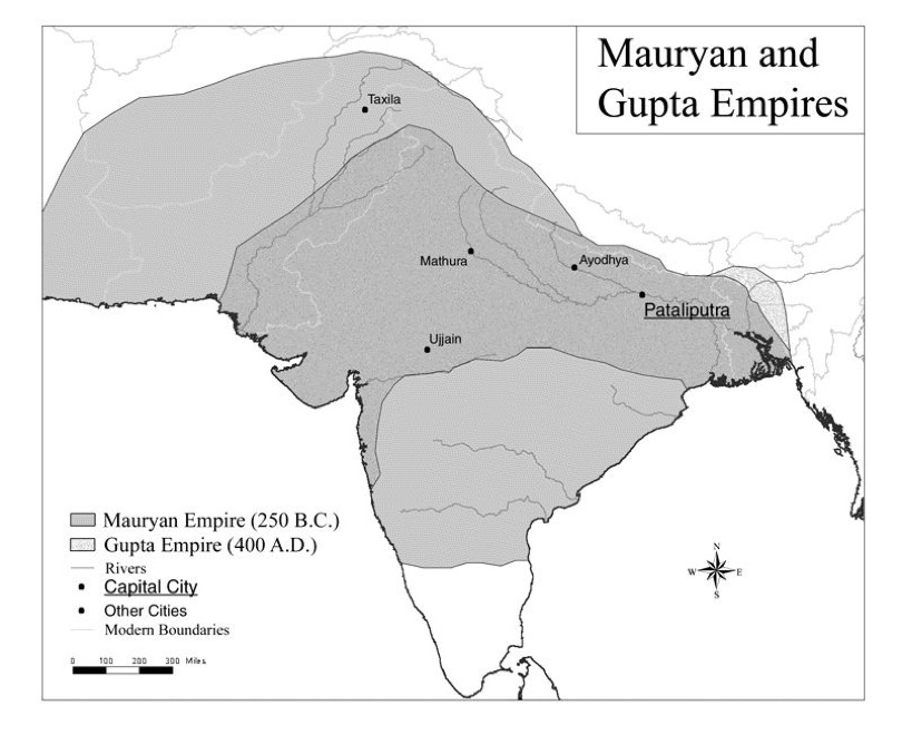
Together's depiction of early agricultural societies (Map 2–1: "The World in the Third Millennium BCE"), on a map where Europe is the only sub-region of Afro-Eurasia that sports no vegetation, even asks, "What strategies did people develop to live in their environments?" The World actually includes two iterations of physical global geography maps within its chapters. While theoretically I approve of this approach, the results are executed somewhat poorly. The first example, "Map 5.3: World Geography and Communication/Cultural Exchange," illustrates the impact of global vegetation, topography, and weather systems on long-distance human relationships, emphasizing isolating factors that are highlighted in the text. This map and its companion, "Map 13.6: Grasslands Compared," restate Jared Diamond's thesis that the lengthy east-west axis of Eurasian geography was the reason for the emergence of more complex societies on that landmass, and the north-south orientation of Africa and the Americas served to their societies' detriment in the development sweepstakes.21 Unfortunately, these two maps undermine their own arguments. Map 13.6 actually deforms the projection to unnaturally elongate Eurasia, while Map 5.3 contains symbols that depict the diffusion north and south of goods and crops in the Americas. Map 13.6 also contains two falsehoods, noting that the Sahel "never became a conduit of cultural exchange until the nineteenth century," and that the "productive economies [were] at either end" of Eurasia, implying that the Middle East and South Asia were unproductive.22 Human Migrations The texts' depictions of human global expansion are pretty similar, the only substantial variations revolving around whether the authors include competing human species and relatively recent insular colonizations. Because of his thematic approach, only Strayer opts to include the Austronesian radiation alongside the earliest movements of Homo sapiens. Certainly the underlying thesis here is the interrelatedness of all (recent) humanity. All four texts supply an independent map to show the dispersal of either Austronesians or Polynesians. Fernandez-Armesto not unreasonably separates the Indian Ocean and Pacific branches into two maps, curiously including the colonization of Madagascar in a map (11.3) entitled, "The Indian Ocean from Ethiopia to Cambodia 1000–1200." His depiction of the range of Polynesians, unlike the other three, is static, perhaps to emphasize the chapter's point about the second millennium ce isolation of these societies; only the hint of an arrow on an earlier map (Map 2.2) historicizes their colonization of the Pacific. Conversely, Bulliet's inclusion of Zheng He's fifteenth-century voyages on "Exploration and Settlement in the Indian and Pacific Oceans before 1500" (Map 16.1) alongside Austronesian colonization (some undertaken 6000 years before present) has the paradoxical effect of insinuating an unchanging East even while depicting the movements of Eastern peoples. (Polynesians also seem to emerge originally from Fiji.) With the aforementioned exception of Austronesians, and the Bantu occupation of sub-equatorial Africa (described below), the textbooks are shy about presenting post-Neolithic human migrations traced through linguistic evidence. Bulliet offers only the spread of (Map 3.3) "The Celtic Peoples" from 500 bce to 200 bce, but the map supplies no evidence for surrounding or displaced populations, even though the caption does. Although Together's "Original Language Family Groups" (Map 1–3) only shows static linguistic origins, the authors accommodate "Indo-European Migrations, 2nd Millennium bce," (Map 3–3) oddly truncating from the map the European peninsula west of the Peloponnese. The World presents the Thule Inuit "migrations" (Map 11.1) on a map shared with Norse settlement around the North Atlantic rim. This framing has the beneficial effect of historicizing Amerindian colonization, whereas none of the other texts revisit the Americas' Siberian colonizers after the initial wave of settlers. By equating Inuit movements with the migrations of contemporary Europeans, the map in effect is arguing that exploration was unexceptional for all humans, no matter what their (sub-)continental origins. Although the evidence is not drawn from linguistic scholarship, the Tignor volume is particularly good with regard to nomadic invasions of more settled lands, offering no fewer than four maps to describe the movements of these peoples, including intra-steppeland relocations. The lack of other examples of linguistic cartography seems to me a missed opportunity. There are interesting historical possibilities for discussing the Central Eurasian languages, such as investigations of the stories of pastoralist-farmer relations, the use of non-written evidence for history, or the various processes that Islamicized different groups of "Turks." A mapped analysis of the Afroasiatic language family might challenge students' concepts of race, complicate the notion of an isolated Sub-Saharan Africa, and reveal the creativity of African food-producing strategies across a series of biomes. Depictions of these other migrations might also make the Bantu movement appear less freakish as a historical process, which is implied by the cartographic habits of current textbooks. All four of my samples present a very simplified schematic of the Bantu-speakers' colonization of tropical and southern Africa. Obviously an "event" lasting four millennia must be abridged for a global history, but the demonstrations elide some complexities that would not be so difficult to portray, particularly the "backfilling" that took place in some of the forested regions. Together and The World associate the farmers' spread with iron technology, but earlier and later technologies which assisted this colonization should be included as well: polished stone tools, the banana, and livestock. Bantu societies, like the farmers on other continents, should evolve over time. Africans' incremental adaptations of these tools will not fully shake student beliefs about the continent's backwardness, but this depiction would subtly erode the accepted notion of "unrewarding gyrations."23 Together historicizes the spread of agriculture in the northern half of Africa on a continental map, and even more rewardingly situates that knowledge among the expansions of agriculture in Europe, Eastern Eurasia, and the Fertile Crescent. Earth, too, successfully shows the spread of agriculture in the northern half of Africa in a global context. Classical Polities Jeremy Black reports that the focus on the Classical (Mediterranean) world was "the traditional cartographic agenda" for historical atlases from the eighteenth century, a paramountcy only further reinforced by the growth of archaeological research in the modern era.24 A substantial number of Classical cartographic tropes populate the middle chapters of our subjects here. At least three of the textbooks include each of the following: the colonization of the Mediterranean by Greeks and Phoenicians;25 the maximum territory of the Achaemenid Empire and Alexander's dismantling of the same; the Eurasian silk (and sea) road(s); the greatest extent of the Roman Empire; the greatest extent of the Han Empire; the Mauryan Empire; and Meso-American civilizations. Underlying many of these maps are recurring Orientalist insinuations. With the lack of non-Western generals as counterexamples, Alexander's mapped march reifies the notion that the "West" has always been the conqueror of the "East," and an individualistic culture at that. As Wigen and Lewis suggest, "[Y]esteryear's global geographies have impressive staying power. Their moral implications may shift over time, but metageographical conceptions rooted in the European intellectual tradition are still very much with us . . .."26 Even though we can see that imperial rule predominates as the theme here, the two Persian empires that emerged subsequent to the Hellenic era are literally peripheral to the three of the books maps, when they appear at all, with the exception of Together, which situates the Parthian polity at the center of Afro-Eurasian trade c. 150 ce (Map 6–3). The Roman Empire certainly draws more coverage than the Han Empire, a defensible decision as it lasted a couple centuries longer. However, the old Orientalist notion of a stagnant China helps inform a majority of the maps. Most flagrantly, the Han Empire does not rate an appearance in The World, even as it is sited among other early political colossi in the text.27 In terms of the rise of the Empire, but especially in expressions of its collapse, the Han possesses no graphic motion according to the cartographers for Strayer and Bulliet; the dynasty appears full-blown and disappears just as completely, though Strayer tenders a miniature map of the revolt of the Yellow Turbans. An observer might object to this complaint: other empires come and go just as quickly on the world historical stage, according to most maps' renditions. However, the Roman Empire grows graphically through its conquests, and the invasions which collapse its western half are carefully traced. Only Tignor's text offers a dynamic Han that is the equal of its Roman counterpart, expanding piecemeal across the landscape and submitting to the entry of "barbarians" from the north.28 The choice to map nearly a millennium of South Asian history in one go brings the Orientalist frame to India as well. Both Ways and Earth overlap the Mauryan Empire with the Guptan, suggesting an inertia endemic to the sub-continent. The temporally similar realm of Charlemagne and the Roman Empire never share the cartographic stage in these texts.
The Spread of Culture The textbooks' coverage for the three salvation religions, Buddhism, Christianity, and Islam, is ample; all cover the theme with multiple and comparative maps.30 Their attention of other "world religions" varies, Together the most accommodating by including Zoroastrianism, "Confucianism and Daoism," Judaism, and Hinduism ("The Spread of Universal Religions 300–600 ce"). The World takes account of "Shinto" and depicts the spread of Hinduism as well (Map 9.1, "The Rise of World Religions to 1000 ce").31 Presentist concerns—the current popularity of Christianity, Buddhism, and Islam—certainly influence these choices, and the maps likely overstate the impact of the religions in their formative years. The modern lens of religious exclusivity—at least in Christendom and Dar al-Islam—is unfortunately reified by the maps' solid color choices. The standard syncretism by which the univeralist religions spread is usually only addressed graphically in China's situation. Bulliet offers the caution of rule by Muslims, rather than conversion, in his title, "Map 9.1, Early Expansion of Muslim Rule," which is unsurprising given his research. After the initial growth of the three salvation religions, Earth and Ways tend to assert the Toynbeean (or perhaps Hungtingtonian) civilizationality of Islam far more often than its counterparts at the ends of Eurasia. "Christendom" evolves into "Europe" and the Buddhist (or Confucian) world develops into "Asia" or the "Ming." Neither The World nor Together use Dar al-Islam as an overarching construct in the late Middle Ages, and both map "Latin Christendom" in 1300. However, these two only depict institutional learning in Europe; neither madrassas nor shuyuan academies appear on their maps.32 Buddhist temples, Muslim mosques, and Christian cathedrals are on equal footing, but the educational systems are not, at least according to the cartography. The maps thus argue that secular education is exceptional to Europe. Recently proposed geographical conceptions have been useful to dismantling Eurocentrism, but they have yet to be fully incorporated into textbook maps. I find David Christian's notion of "Outer Eurasia" exceedingly useful to teach the first half of world history, even if the idea was more of a lucky side effect resulting from the categorization of Inner Eurasia.33 Inner and Outer Eurasia do not appear solidly on these texts maps, but as indicated earlier Inner Eurasian activities feature prominently in Tignor. Lynda Shaffer's "southernization" has often been anthologized, and while it has not yet labeled as such on maps, has emerged unnamed in some cartography.34 The influence of Buddhism from South Asia, addressed above, now packs visual heft in world history maps. The movement of agricultural technologies out of "India" now graces Together's "Agricultural Diffusion in the First Millennium" (Map 9–4), as well as The World's "Transmission of New Crops to the Islamic World ca. 1000" (Map 10.3). These breakthroughs can only signal good news for world history's cartographic future. Conclusion and Solutions As I have gained more experience
as a teacher, I have found myself making interventions in the maps I have used,
photocopying originals and drawing in my own corrections to what I felt was
missing or misleading information. One notable example of this practice
was with Janet Abu-Lughod's "The Eight Circuits of the Thirteenth-Century World
System."35 Like many other
instructors, I found this map incredibly useful for explaining a number of
elements of Early Modern history, but from an East Africanist's perspective
there is a glaring omission: the monsoon trade that sailed to and from the
Swahili coast was absent from the map. So I drew in my own trading
circuit that did not leave East Africa out of global history.
Subsequently, I was delighted to discover that Robert Strayer (or his
cartographers) had done something quite similar, but professionally in his
textbook.36 In fact,
Strayer's map went further, adding two entirely new trading circuits, a
trans-Saharan and a Baltic system.37 This is, of
course, a crude and not always feasible strategy to improve cartography, and
rarely will such a serendipitous convergent evolution result. So what can
we do, as teachers, beyond just reading the maps more carefully? The major option is to cast a wide net for supplementary maps; depictions that might tell otherwise untold stories, though most historical cartographers work in an idiom similar to those of the textbooks. Challenges to Eurocentric mapmaking have emerged in the late twentieth century, a lot of the work revolving around the choice of projections, like Arno Peters' intervention and MacArthur's Universal Corrective Map. "The Times Atlas of World History (London, 1978) made a definite attempt to break away from Eurocentricity . . ." through both choice of coverage and projection, and has been influential on subsequent historical atlases.38 I strongly recommend the Prentice Hall Atlas of World History (second edition), as a supplemental text for either teacher or students, as its coverage is resolutely global.39 Regional historical atlases offer insights potentially missed by textbooks' scale. The World Wide Web and computer software have lent themselves to making animated histories, able to discard some of the limitations of paper maps and tell a powerful story. One (modern era) website that does this very well (with a particularly conducive subject) is the Animated Atlas of African History (1878–2002) <http://www.brown.edu/Research/AAAH/map.htm>.40 Clever cartographic innovations can be unearthed across the Internet. Most historical maps on the Web, however, continue to privilege the representation of the state above all other geographic data. As discussed by Jeremy Black, this is often unsuitable for pre-modern history: "Clearly contrasting primary colours and firmly delineated frontier lines do not describe adequately or accurately problems of multiple allegiances, overlapping jurisdictions and complex sovereignty or societies that lacked a sense of rigid and clear-cut territorial units."41 Most of all, we should read all our maps very carefully, assessing whether they express the same history as their texts claim. And we should teach our students this process of understanding historical maps, too. Further Reading: Jeremy Black, Maps and History: Constructing Images of the Past (New Haven: Yale University Press, 1997). A history of how historical atlases have been constructed and the motivations that shaped their production. Kären Wigen and Martin Lewis, The Myth of Continents: A Critique of Metageography (Berkeley: University of California Press, 1997). An indispensible look at the concepts that inform geographical knowledge. J.B. Harley, The New Nature of Maps: Essays in the History of Cartography (Baltimore: John Hopkins University Press, 2001). Anthology of essays on the philosophy of reading maps (mostly historic rather than historical). Michael McInneshin is an assistant professor of African History at La Salle University. He recently published "Collaborative Landscape: Missions, States, and Their Subjects in the Making of Northeastern Tanzania's Terrain, 1870–1914," in Missions, States, and European Expansion in Africa. He can be contacted at mcinneshin@lasalle.edu. |
|||||||||||||||||||||||
|
|
|||||||||||||||||||||||
|
Notes
1 S.A.M. Adshead, China in World History (New York: St. Martin's Press, 1988), 1–2. 2 Sometimes campaigns other than the Macedonian are very generally described, with the arrows used to depict the expansion of certain empires, but only sporadically are particular marches reproduced. The Mongol campaigns make an occasional appearance, though usually their maps depict the breadth of Genghis Khan's empire at its height (or after its quartering). For Mongol routes, see Felipe Fernandez-Armesto, The World: A Brief History (Upper Saddle River: Prentice-Hall, 2008), 318–19. 3 Jeremy Black, Maps and History: Constructing Images of the Past (New Haven: Yale University Press, 1997), 44. 4 See however World History Maps <http://www.worldhistorymaps.com/index.htm> for possible electronic utility. 5 "[C]ountries are not necessarily the essential units that we often imagine them to be. . . . the nation-state is a dubious concept for economic as much as for cultural analysis." Kären Wigen and Martin Lewis, The Myth of Continents: A Critique of Metageography (Berkeley: University of California Press, 1997), 8–9. 6 Wigen and Lewis, Myth of Continents,11. 7 Denis Wood, The Power of Maps (New York: Guilford Press, 1992), 17–25. 8 See, for an historical example, Simon Ryan, "Inscribing the Emptiness: Cartography, exploration and the construction of Australia," in Chris Tiffin and Alan Lawson, eds., De-scribing Empire: Post-colonialism and Textuality (New York: Routledge, 1994), 115–30. 9 Eighteenth-century historical atlas-makers worried about the sort of history that was being handed down by their own creations. Jeremy Black, Maps and History, 23. 10 Ross Dunn, The New World History: A Teacher's Companion (Boston: Bedford/St. Martin's, 2000), 109. 11 Richard Bulliet, Pamela Crossley, Daniel Headrick, Steven Hirsch, Lyman Johnson, and David Northrup, The Earth and Its Peoples: A Global History, vol. I, 5th ed. (Boston: Wadsworth, 2011). See also John McKay, Bennett Hill, John Buckler, Patricia Ebrey, Roger Beck, Clare Crowston, and Merry Wiesner-Hanks, A History of World Societies, 8th ed. (Boston: Bedford/St. Martin's, 2009); Jerry Bentley and Herbert Ziegler, Traditions and Encounters, 4th ed. (New York: McGraw-Hill, 2008); and Peter Stearns, Michael Adas, Stuart Schwartz, and Marc Gilbert, World Civilizations: The Global Experience, 3rd ed. (New York: Longman, 2001). No particular cartographic company is credited in Bulliet. 12 Wigen and Lewis, Myth of Continents, 125. 13 Robert Tignor, Jeremy Adelman, Peter Brown, Benjamin Elman, Xinru Liu, Holly Pittman, and Brent Shaw, Worlds Together, Worlds Apart, vol. one, 3rd ed. (New York: Norton, 2011). The cartographer here is listed as "Carto-Graphics/Alice Thiede." 14 Robert Strayer, Ways of the World: A Brief Global History with Sources, vol. 1 (Boston: Bedford/St. Martin's, 2011 (2008)). The cartography here is attributed to "Mapping Specialists Limited." 15 Fernández-Armesto, The World. "Maps designed and produced by DK Education." 16 Stearns, et al., xvii; McKay, et al., vi; Bulliet, et al., xxi. 17 Together, Ways, and The Earth also include a companion map of contemporary political borders in the end pages, in the volumes that terminate in 1500. I realize that this is meant to situate the location of past events in the present, but this inclusion has the drawback of suggesting that territorial states and nation-states were the norm in areas when they were not the dominant political paradigm. Fernández-Armesto is unusually sensitive to climate change also (Maps 1.2, 2.2, 11.1, 13.6, and 14.1). 18 The World portrays "Climate Change in the Fourteenth Century" and includes volcanic eruptions, el Niño, and primary source data on the map. Fernández-Armesto, The World, 346–47. 19 Together, 188; Earth, 219 and 370. 20 Wigen and Lewis, Myth of Continents, 43–44. David Christian suggests that taking the very long view makes geographical differences almost look insignificant with regards to "many large patterns in human history," and "may have more to do with the nature of our species" than the landscapes we lived in. David Christian, "Afroeurasia in Geological Time," World History Connected, February 2008. <http://worldhistoryconnected.press.illinois.edu/5.2/christian.html> 21 Jared Diamond, Guns, Germs, and Steel: The Fates of Human Societies (New York: Norton, 1997), 176–91. For a critique of these claims, see J.M. Blaut, Eight Eurocentric Historians (New York: Guilford, 2000), 153–66. Older historical atlases tended to emphasize the geographical barriers between Eastern and Western Eurasia. Black, Maps and History, 106–7. 22 See Christopher Ehret, Civilizations of Africa: A History to 1800 (Charlottesville: University of Virginia Press, 2002) for examples of ongoing Sahelian technological transmissions from as early as 5000 years ago. 23 Strayer, unfortunately, later depicts the post-migrated Bantu-speakers (as well as the "San") with the same convention used to represent states. Map 7.1, "Africa in the Classical Era," Ways of the World, 285. So a great swath of Central Africa appears to be politically unified, while northeastern Africa sports two tiny states. 24 Black, Maps and History, 27–30. 25 Only Strayer excludes the Phoenicians, a particularly egregious omission given his comparative approach. 26 Wigen and Lewis, Myth of Continents, 72. 27 Fernández-Armesto, The World, 157–72. 28 Unfortunately the convention used to express the growth in this—and the Roman—map lacks clarity. 29 Black, Maps and
History, 61. See, for example Historical Maps of the World 30 The discrete stages of the early spread of Islam are nearly identical for all the texts: the expansion is periodized by the leadership of Muhammad, the "Rightly Guided" caliphs, and the Umayyads. 31 "Shintoism" is a bizarre choice to include here, though it might be considered a smaller parallel to what is called "Hinduism" in South Asia. Although none have tried to map the African equivalents of Shinto, Christopher Ehret's Civilizations of Africa offers many textual guidelines should someone care to make the attempt. 32 Tignor, et al., Together, 390; Fernández-Armesto, The World, 334. 33 David Christian, "Inner Eurasia as a Unit of World History," Journal of World History 5 no. 2 (Fall 1994), 173–211. 34 Lynda Shaffer, "Southernization," Journal of World History 5 no. 1 (Spring 1994), 1–21. 35 Janet Abu-Lughod, Before European Hegemony: The World System A.D. 1250–1350 (New York: Oxford University Press, 1989), 34. This map is replicated in the Rand McNally Historical Atlas of the World (Skokie, Rand McNally & Company, 2006), 31. 36 Strayer, Ways of the World, 543. Map 12.2, "Trade and Disease in the Fourteenth Century." 37 It appears that some of this innovation may have come from a map in Christopher Chase-Dunn and Thomas Hall, Rise and Demise: Comparing World-Systems (Boulder: Westview Press, 1997), 153. 38 Black, Maps and History, 144 and 199–200. The Times Atlas of World History certainly influenced Fernández-Armesto's cartographers. See also Dunn, New World History, 111. 39 The Prentice Hall Atlas of World History, second ed. (Upper Saddle River: Pearson, 2009). The Rand McNally Historical Atlas of the World and Longman Atlas of World History (Santa-Barbara: Maps.com, 2009) suffer from the deficiencies common to the textbooks. 40 The animations' origins mostly lie in an older paper source, however: Colin McEvedy, Penguin Atlas of African History (New York: Penguin, 1996). 41 Black, Maps and History, 218.
|
|||||||||||||||||||||||
|
|
| Home | List Journal Issues | Table of Contents |
| © 2011 by the Board of Trustees of the University of Illinois |
Content in World History Connected is intended for personal, noncommercial use only. You may not reproduce, publish, distribute, transmit, participate in the transfer or sale of, modify, create derivative works from, display, or in any way exploit the World History Connected database in whole or in part without the written permission of the copyright holder. |