| |
|
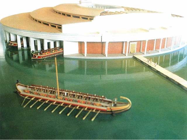
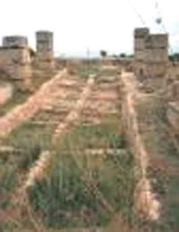
Paper
Trails: Port Cities in the Classical Era of World History
Marc Jason Gilbert
North Georgia College and State University |
|
| |
|
|
Port cities are a staple of world history. They
are hubs of world commerce and also of regional trade between coast and
hinterland. They are facilitators of both immigration and emigration.
They are transit points for the spread of disease as well as goods and
people. They are also markers of patterns of colonialism and development.
The capitals of most developing countries betray their colonial roots,
having ports as their capital and/or largest cities that today remain
the loci of virtually all post-colonial national administrative, educational,
and medical institutions. They are prime drivers of urban sprawl and slums
as well as economic growth. Yet, the tolerant, permissive and multicultural
atmosphere of port cities in developing as well as developed societies
also make them rich centers of world culture, from break-dancing in Douala
to high rise living in Singapore and Shanghai, to the literature generated
by Alexandria (Lawrence Durrell's The Alexandria Quartet), Mumbai
(Salman Rushdi's Satanic Verses, Manil Suri's The Death of Vishnu)
and Saigon (Grahman Greene's The Quiet American and Margurite Duras'
The Lover), among others. Indigenous cultures often arise from
sea entrepots (the Swahili ports of East Africa), are often transformed
by them (British Calcutta) or end there (Powhattan's New York). Moreover
port cities come in many forms other than coastal enclaves: Phoenix's
Sky Harbor reminds us that airports are also ports of call in analytical
terms. The landlocked harbors of Lothal in India and Bawtry in Yorkshire
remind us that even in historic times changes in coastlines and sea levels
have varied sufficiently to affect human activity. |
1 |
|
So integrated into world historical processes are
the lore of ports of call that they represent one of the few subjects that
one can entrust to Wikipedia for background information and to amazon.com
for relevant scholarship. Merely googling "third world cities" garners the
indispensable work of the same title edited by John D. Kasarda and Allan
M. Parnell (1992); while googling "port cities, Third World" locates John
Middleton's review of Michael Pearson's "Port Cities and Intruders:
The Swahili Coast, India, and Portugal in the Early Modern Era" in
the Journal of World History, 11:1 (Spring 2000): 126-129. Richard
Pankhurst offers an online study of the sea commerce of ancient and medieval
Arabia, Ethiopia and the horn of Africa at http://www.addistribune.com/Archives/2002/07/26-07-02/History.htm.
Allen D. Furford provides a lexicon for ancient ports and identifies a number
of them from Japan to Bermuda at http://www.seanet.com/~julie321/seaports.html.
The ancient ports of Sri Lanka are closely studied at http://www.lankalibrary.com/geo/ancient/ancient_ports2.htm,
while Abdera in Thrace is noted at http://www2.rgzm.de/Navis2/Home/HarbourFullTextOutput.cfm?HarbourNR=Abdera.
This article, the first of a projected series, will identify evocative
images and virtual tours of selected ports of the ancient world so as
to facilitate their introduction into the classroom.
|
2 |
| |
|
| Lothal |
|
|
|
|
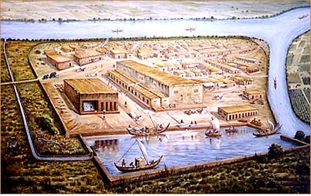
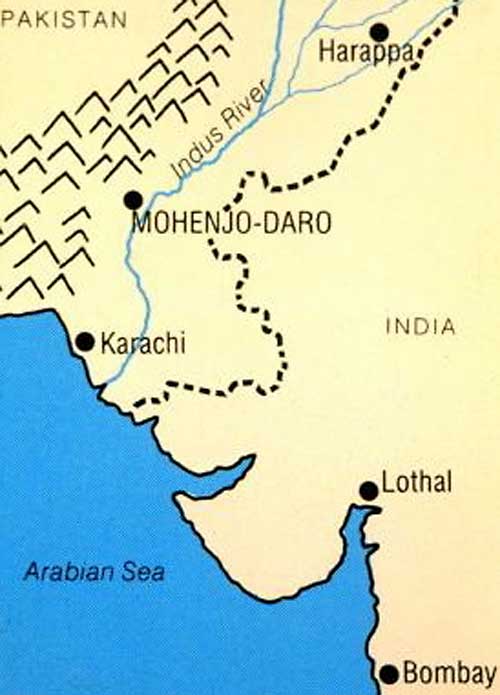
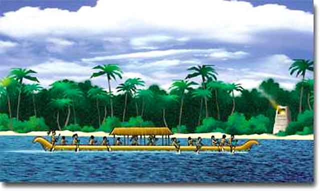
Sometime after 2400 B.C, one of the greatest port
cities of the ancient world flourished near where the Indus and associated
river systems flowed into the Indian Ocean at a site now called Lothal.
Lothal featured perhaps the world's first tidal dock, which permitted ships
to enter into the dock through a northern inlet channel connected to the
estuary of the river Sabarmati. The closure of the lock gates permitted
the water level to remain high enough to float the ships at the dockyard.
The ships that left from Lothal's 700 foot brick-lined wharf traveled to
destinations as distant as the Sumerian city Ur in the delta of the Tigris
and Euphrates Rivers, though most of their cargoes were sold at or trans-shipped
from ports in the Persian Gulf where they stopped to trade. Arriving ships
often carried Sumerian tools and tin (used in India to make bronze, a process
that also used copper from as far away as Afghanistan). When outgoing ships
arrived at their destinations, the local inhabitants would have rushed to
examine their cargoes, which included cotton fabrics, exceptional manufactures
such as fine-drilled gemstone beaded jewelry and welcome foodstuffs, like
barely and wheat grown in Indus Valley cities and towns, which spread out
north of Lothal along the Indus River and its tributaries. The richness
of these inter-regional and local exchanges has suggested to some that the
concept of center-periphery relations in the ancient world itself needs
further work (see http://www.adventurecorps.com/archaeo/centperiph.html). |
3 |
|
|
|
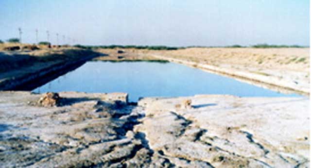
Today, Lothal lies many dry and desolate miles inland
from the Indian Ocean. Its great dock was buried beneath sand and silt sometime
after 1900. B.C., perhaps due to a possible massive flood around 2200 B.C.
that led to 300 years of slow decline. Eventually, silt covered Lothal as
it did the great cities it served in the hinterland. Research into its ruins
confirms not merely the great uniformity and worth of Harappan urban planning,
but the ingenuity of its people. For a virtual tour of Lothal, with student
exercises, go to http://www.harappa.com/lothal/.
For more information on Indian sea navigation, see http://www.crystalinks.com/indiaships.html.
For India's maritime history, see http://indiannavy.nic.in/maritime_history.htm
and K. S. Behera (ed.), Maritime Heritage of India (1999), which
provides commentary on India's eastern ports. |
4 |
| |
|
| Xel
Ha |
|
|
|
Ever since Hernán Cortés reported
his acquisition of a Mayan map, western scholars have known that Mayans
had port cities, and in great number, as Mayan ports were spaced at a day's
rowing distance apart. Though most of these ports expired after the conquest,
we still know much about them, and in the last two decades they have dramatically
remerged as tourist ports-of-call The Mayan port of Xaman-Ha is now the
tourist Mecca of Playa del Carmen; ancient Pole, with its (once pristine)
underground water-tunnels is now part of the water-park at Xcaret; Zama
is near Tulum (the sea-side later Mayan city depicted in numerous films
such as Against All Odds), and Cozomel was both a trading center
as well a religious center.
|
5 |
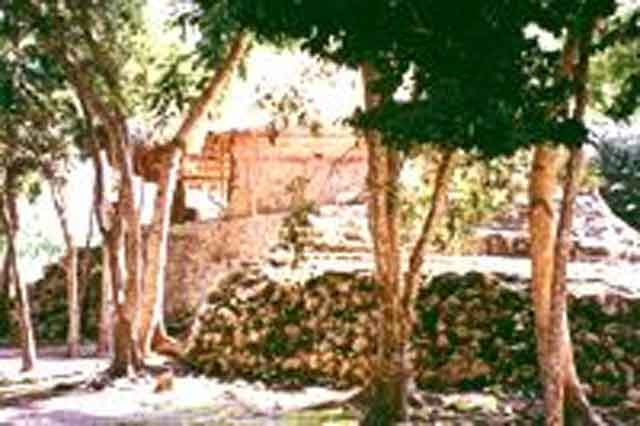
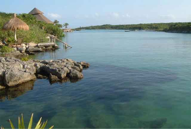
One of these ports, Xel-Ha, first served as the
port of the city of Coba in the interior of Yucatan. It is eight miles from
Tulum, a later city which came to control the port. Xel-Ha's beautiful lagoons
may now be over-used by snorklers and divers (including this writer who
has been visiting the region since childhood), but its links with Coba and
Tulum and its own history is only just beginning to be explored.
|
6 |
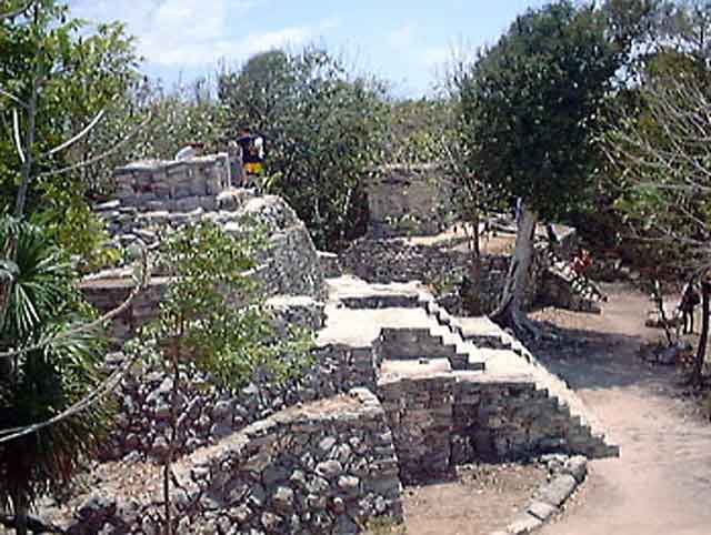
Coba was established originally as a classic Mayan city
(600-900 A. D.) located about 42 miles west of the later site of Tulum.
It was built between two lakes and is a very large site, encompassing approximately
60 square miles. It was the hub of the largest number of paved roads (16)
in the Mayan world and contains the 138 foot tall post-classic Nahoch
Mul, one of the highest of all Mayan pyramids. Since Xel Ha served so
large a center, it is not surprising that it was itself a large complex:
some argue it covered the largest area of any Mayan city. Its virtually
untouched ruins include a pyramid, palace and associated structures, as
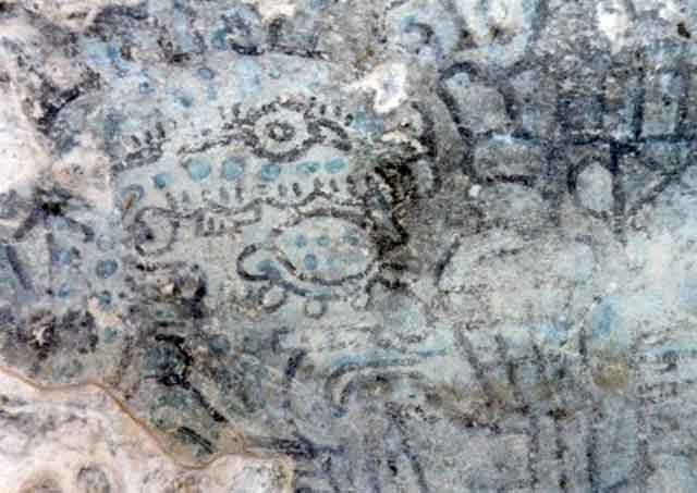
well as what is thought to be a muelle or dock. Its artistic output
included frescos that can still be seen. Pictured below are port buildings,
pyramids, fresco and the lagoon today. Photographs are courtesy of http://www.akumaladventures.com/xelha.html.
|
7 |
|
|
According to legends recounted by local guides,
"the gods were so pleased with their creation that they decided to share
it with man; but declared the iguana (land) and the parrot fish (sea) to
be sacred guardians of Xel-Ha." (See http://fsweb.bainbridge.edu/bdubay/mexico/xel-ha/xel-ha.html).
More reliable is the derivation of its name, which means "place where the
water is born," as the pristine springs that feed the lagoons suggest.
|
8 |
Xel Ha provides an instructor
with an opportunity to develop exercises regarding trade and avoid or supplement
more familiar sites such as Chichen Itza. Such efforts can be facilitated
by exploring Mayan navigation more closely at http://www.mayadiscovery.com/ing/history/default.htm
(scroll down to Mayan Navigators) and http://www.spanishome.com/activities/mayas/trade.htm.
Students can be assigned to examine another site of equal or even surpassing
current interest at Ambergris Caye, which can be explored at http://www.ambergriscaye.com/pages/mayan/earlyhistory.html
and http://www.ambergriscaye.com/pages/mayan/ambergmaya.html.
Books that discuss Mayan trade include Linda Schele and Peter Mathews: The
Code of Kings (1998), Guiseppe
Orefici, Maya (1998), Robert Sharer, The AncientMaya
(1994) and Gene S. Stuart, and George E. Stuart: Lost Kingdoms of the
Maya (1993).
|
9 |
| |
|
| Ostia/Portus |
|
|
|
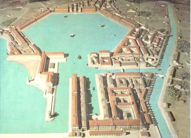
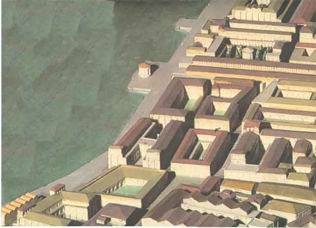
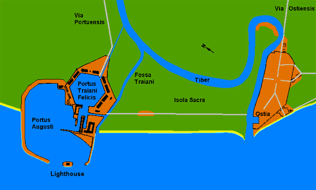
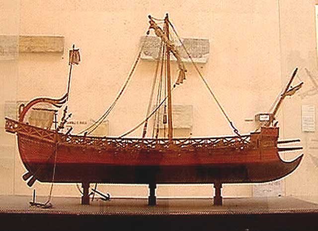
Ostia, Rome's port city on the Tiber, featured two
harbors. The second, Portus, was built to cope with the rising trade with
Spain and north Africa, which is well known, and also with India, which
trade is lesser known, but was nevertheless quite important during the last
years of the Republic and early decades of the Empire. The use of these
harbors climaxed in the second century A.D. and declined thereafter.
|
10 |
|
|
This site also offers a street-by street reconstruction
of Ostia town and old port (left). See http://www.ostia-antica.org/map/ostia-m.htm
and click on map section.
|
11 |
|
|
Lindsey Davis's novel Scandal Takes a Holiday
(2004) not only includes fully developed maps and cityscape, but illustrates
virtually every socio-political and religious aspects of life in Ostia/Portus
in approximately 76 A.D. The tale is one of the best of the author's series
of stories about a fictional Roman informer, or private detective. As in
most historical novels, there are some anachronisms in speech and character,
but here a close study of Ostia is at center stage: the reader is given
a vivid tour of Ostia's food stalls, temples, police barracks and villas,
as well as insight into its politics from guilds to pirates.
|
12 |
|
The website "Ostia: harbour of Ancient Rome" at
http://www.ostia-antica.org/
offers not only maps and 3-D reconstructions, but a complete illustrated
history (http://www.ostia-antica.org/intro.htm#32)
and primary sources, including remarks on Ostia by dozens of Roman writers,
such as the following from Plutarch at http://www.ostia-antica.org/anctexts.htm:
|
13 |
| |
|
| PLUTARCHUS |
|
| The
Greek author Plutarchus (c. 46-127 AD) was procurator of Achaea under Hadrian.
He is best known for his Parallel Lives, biographies of eminent Greeks and
Romans, composed in pairs. |
|
| |
|
Parallel Lives, Caesar
58, 10
In the midst of the Parthian expedition he was preparing to cut through
the isthmus of Corinth, and had put Anienus in charge of the work. He
also proposed to divert the Tiber immediately below Rome by a deep canal
which was to run round to the Circaean promontory and be led into the
sea at Terracina. By this means he would provide a safe and easy passage
for traders bound for Rome. In addition he proposed to drain the marshes
by Pometia and Setia and so provide productive land for thousands of
men. In the sea nearest Rome he intended to enclose the sea by building
moles, and to dredge the hidden shoals off the coast of Ostia, which
were dangerous. So he would provide harbours and anchorages to match
the great volume of shipping. These schemes were being prepared. [Translation:
R. Meiggs, Roman Ostia, p. 53.]
|
14 |
| |
|
| Carthage |
|
|
|
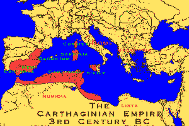
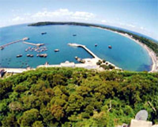
15 |
The imperial capital's port at Carthage near modern
Tunis is an engineering marvel, one that reminds us that Romans were not
the only advanced technologists of their time. Indeed, the Romans copied
Carthaginian ships in building up their own navy. They later strengthened
this model with Athenian ship designs, an act that demonstrates their early
capacity for synthesis and may serve as another indicating that Greek sculpture
was but one of the many Greek styles which Romans borrowed from their predecessors.
|
16 |
|
| |

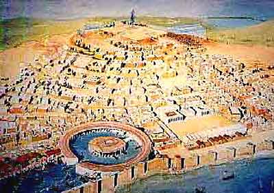 |
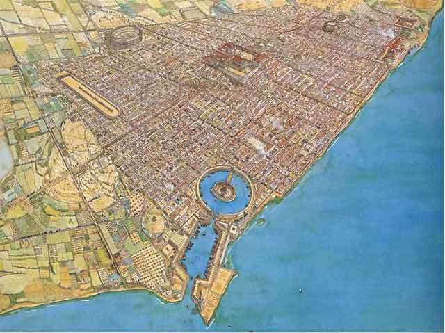
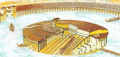
Aerial
views of the city of Carthage and its port not far from
present day Tunis.
|
|
|
|
|
| |

|
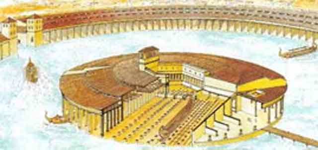
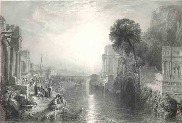
Above,
a cutaway view of the inner harbor, the remains of the
boat ramp and an engraving of J. M. Turner's painting
of Dido building the city and harbor. Below, an artist's
reconstruction of the inner harbor and a replica of the
type of Carthaginian ship captured by the Romans who copied
the design.
|
|
|
|
|
|
|
The Carthaginian Empire's role in shaping the early
Mediterranean world, the nature of its own unique culture and its destruction
by Rome are examined at http://www.livius.org/carthage.html.
This site provides links to articles, biographies and primary sources relating
to Carthaginian history. Other websites providing narrative histories of
the empire or address its trade, economy and technology include http://phoenicia.org/puniceconomy.html
and http://www.channel4.com/history/microsites/C/carthage/.
|
17 |
| |
|
| Hepu |
|
|
|
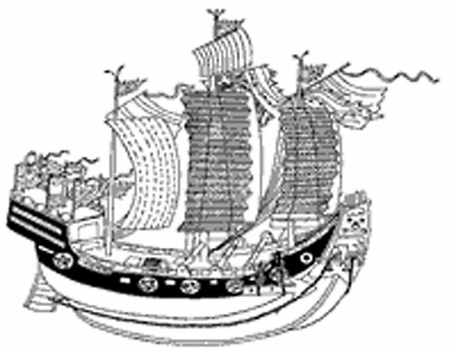
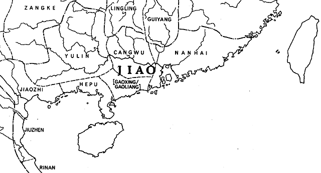
Hepu, like Lothal, was a major port which was lost
for centuries and whose recovery has added much to our understanding of
the place of port cities in world history. Now located within Beihai City
in Hepu county in south China's Guangxi Zhuang Autonomous Region, Hepu has
revealed to archeologists that it was perhaps China's oldest seaport and
thus the oldest port on the Silk Route. Its history also illuminates why
it became "one of the main overseas Chinese hometowns of China."
|
18 |
|
|
According to the Chinese government, archeological
work has recently shown that the site of Hepu was "the oldest departure
point on the country's ancient maritime trading route." This status was
spurred by its role as a transportation hub: as a water port, it served
as the "main gate" for the "Silk Road on the sea," while a secondary
channel via the Western River tied Hepu to Wuzhou and Guangzhou. Hepu was
also connected to Indochina generally by sea, while a southwestern mountainous
route connected it to northern Vietnam.
|
19 |
|
Records suggest that, in keeping with the Han expansionist
policy, Hepu was integrated into the empire in 111 B.C. when Lianzhou Town
at Hepu became a three-tiered local administrative seat. The ruins of Hepu
port appear to date from the Western Han Dynasty (206 BC - 24 A.D.). The
city was walled and surrounded by a moat and was prosperous enough to be
the site of Han tombs. Funerary objects and pottery pieces that have been
excavated date from as late as 220 A.D. They include "imported jewelry and
utensils fashioned from such materials as colored glazed pottery, amber,
agate and crystal" suggesting the city's role as a major trading port. Researcher
Xiong Zhaoming remarked that "The gentle slope between the moat and
the city walls means such works were not meant for defense, but served as
a symbol and for trading convenience." (See http://www.hartford-hwp.com/archives/55/747.html.) |
20 |
| |
21 |
|
As Hepu grew in importance, some traders immigrated
from Guangxi to Yanluo or other places in the Western Han dynasty, a process
which continued apace under successive dynasties, particularly during the
outward looking years of the Ming. Many immigrated "to Vietnam, Thailand,
Malaya and other south Asia countries." When the Taiping Uprising failed,
"the farmer uprising army couldn't find a foothold in China, and they had
to escape successively to Vietnam, Malaya and other places, and the amount
was more than 10 thousand." From records at Hepu and elsewhere, it appeared
that such migrations occurred frequently as a result of failed uprisings.
In 1679, many Ming dynasty leaders in the south refused to surrender to
the Qing dynasty and boarded "over 50 warships and more than 3000 subordinations
to flee from the coastal area of Guangxi to Kampuchea (which then encompassed
the Mekong delta)." After the end of the Opium War, many southern Chinese
laborers were purchased or recruited by the Western nations who shipped
them throughout Asia and Africa. In the years 1900 to 1911, over 20 thousand
local workers were dispatched in this manner. Speeding this process was
Chinese oppression of the ethnic minorities that populated the region. According
to contemporary Chinese authorities, who rarely miss so rich an opportunity
to condemn the "feudal" regimes of the past, "in Ming times many Zhuang,
Dai, Nong, Miao and Yao minorities in Southwest and Northwest zone of Guangxi
migrated to Burma, Laos, Thailand and Vietnam." They are also careful to
note the leading roles of Chinese ex-patriots from this region who fought
the spread of Western imperialism from the Red River to Cuba and the essential
role played by their descendants in sending remittances that are helping
to drive south China's remarkable economic growth (see the brief history
and statistical data offered at http://www.gxi.gov.cn/English/overseas%20Chinese/survey%20of%20overseas%20chinese.htm).
For other forces driving Chinese out-migration,
especially in the south, see http://www.anu.edu.au/asianstudies/decrespigny/south_china.html.
|
22 |
| |
|
| Conclusion |
|
|
The study of ancient port cities reminds us of the
great continuity of patterns of global interaction. The exchange of goods
between civilizations and coastal/hinterland relations, and advances in
engineering fostering that exchange via efficient dock-building and navigation,
seem to be part of a pattern as old as Sumer and as familiar as containerization.
The ships from Hepu that carried poor and powerless Chinese to a life of
hard labor around the globe should call to mind the ships that much later
were to carry Irish immigrants to America: politics, not merely famine,
played a factor in both events. Sumer's trade in tools for both luxury goods
and foodstuffs with India remind us of that interdependence is not a product
of modern globalization, while Mayan trade patterns leave no doubt that
this was true of world's both old and new. This essay was written in the
hope that instructors might profit from drawing attention to these continuities.
Student can easy follow up the sources cited to explore them in more detail,
perhaps by employing them on scavenger hunts for trade items, or for the
identification and further analysis of ancient trade emporiums including
and beyond those suggested above, such as Athens/Piraeus, Caesarea, Londinium,
etc. A list of many of these ports offering links to each can be found at
http://www.abc.se/~m10354/uwa/harbours.htm.
The modern world economy may, as suggested by Ken Pomerantz and Steve Topik
(The World that Trade Created: Culture, Society and the World Economy,
1400 to the Present, 2000), have been one shaped by international trade,
but ancient global ports of call indicate that our predecessors were no
less concerned with, and effected by, economies well beyond their horizon.
|
23 |
| Biographical
Note: Marc Jason Gilbert is Professor of History at North Georgia
College and State University, and is a University System of Georgia Regents
Distinguished Professor of Teaching and Learning. He is also co-director
of the University System of Georgia's programs in India and Vietnam. He
has published several books about Vietnam, and is co-author with Peter Stearns,
Michael Adas and Stuart Schwartz of the third revised edition of the
world history survey text, World Civilizations: The Global Experience
(2000). |
24 |